
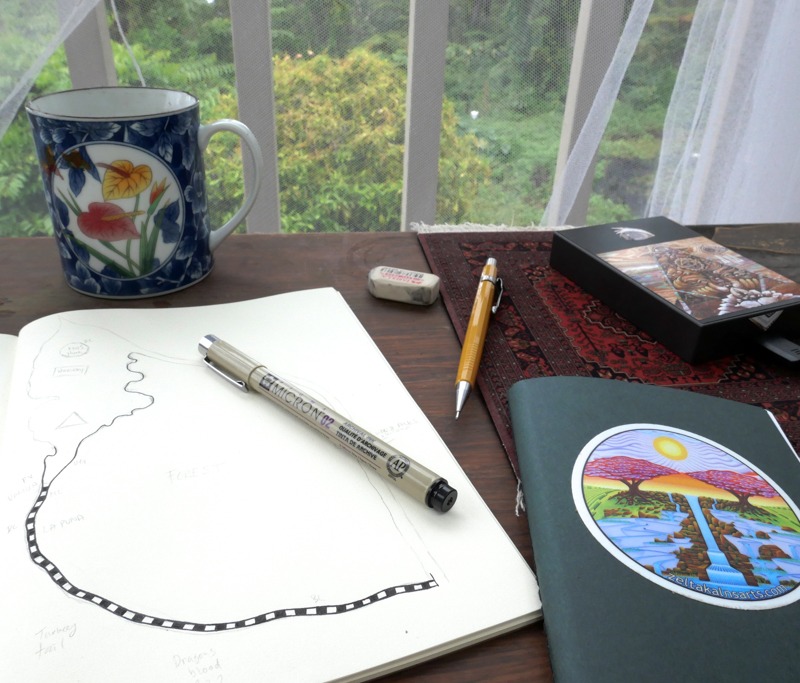
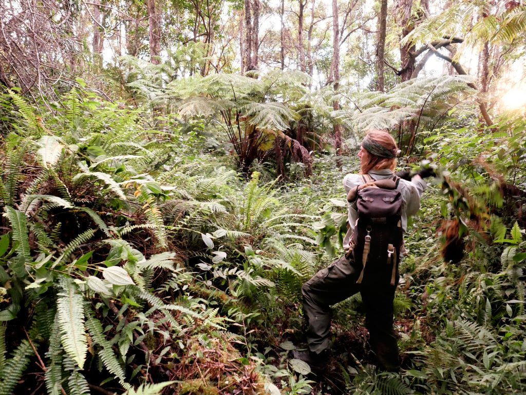
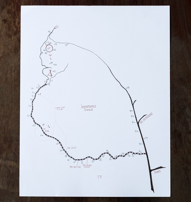
The plants that are of particular interest to the STOMATA project are planted all along the trail that meanders through the dense jungle down the slope from the house. In order to locate and memorise the placement of all of the specimens a map is an essential tool.
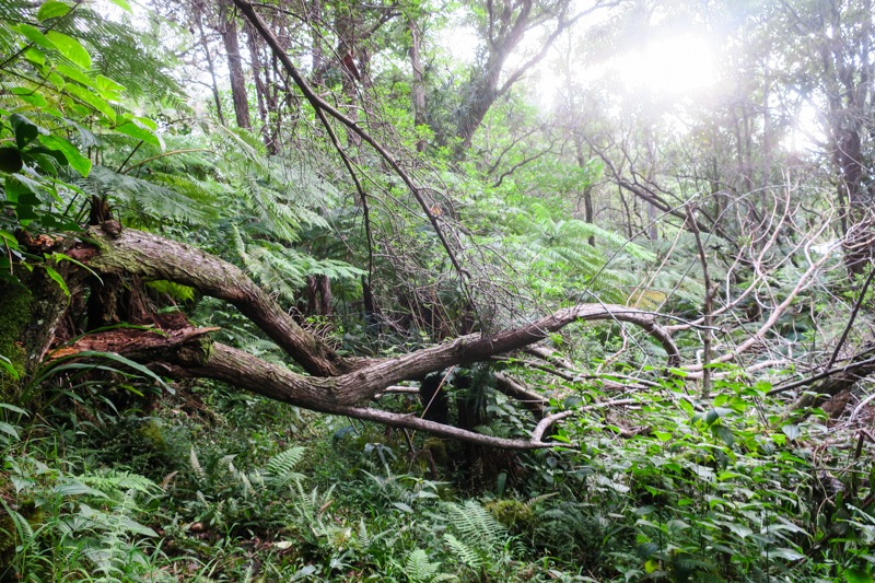
Mapping the area also helps us understand the lay of the land and how different dimensions are woven together. The volcanic bedrock and soil, the flows of water, and plant and animal life all shape the terrain in various ways. Having an overview or birds eye perspective of the site allows us to plan our activities and discuss different projects efficiently. Especially as this ecosystem is situated on a steep incline, along an overgrown path, which often means one cannot see much more than 5-10 meters ahead.
Considering the continuous growth season of the tropics, management is constantly needed. There have been multiple live in caretakers at Botanical Dimensions, although currently there is none (other than us) which is part of the reason for the dilapidated state of the trail and garden. Since the primary reason for our stay here is to gather plant samples and photographing specimens, we spend a lot of time on the trail and in the garden above. Hence we can (and kind of need to) provide basic management of the trail, especially around the specimens that are relevant of the field work.
So far we have weeded most of the trail and tried to remove as many of the invasive species, as possible. Such as Koster’s curse, Clidemia hirta a pretty nice looking, shiny plant with sweet little flowers that cause tremendous damage in many tropical regions.
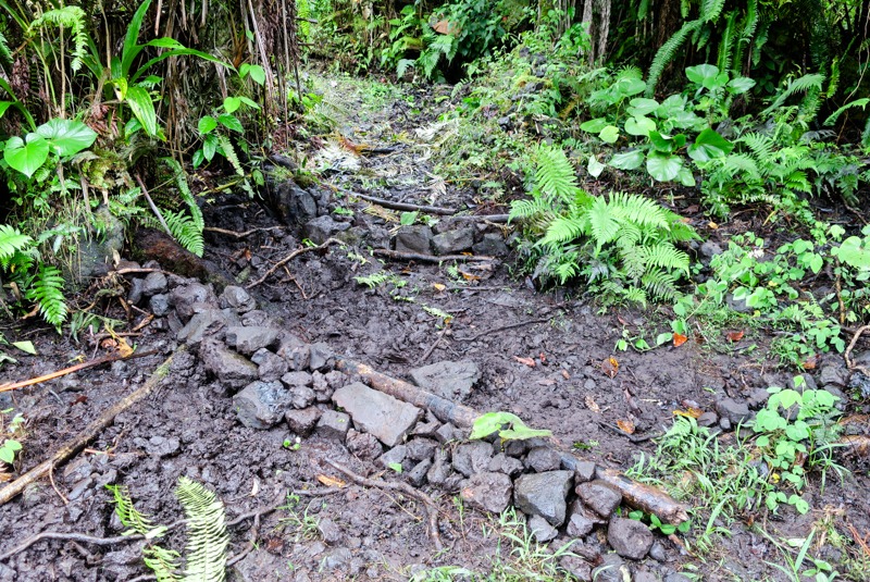
We have begun clearing a maintenance path along the irrigation system, which weaves through the landscape. This allows for for more paths to be taken parallell to the main trail and makes it easier to move through the dense jungle. However, the footing can be very precarious as the volcanic rocks are dark and often loose in the wet soil. The wild boar move rocks around, and wallow in puddles of mud, making the trail less predictable and at times treacherous.
We have experimented with different methods of combating this wear and tear, whilst exploring the trails and removing invasives. However, these designs are mainly small scale experiments, aimed to make the trail walkable for our time here, with a hope to possibly direct the flow of water and animals in ways that does not increase the rate of erosion.
We have also identified what we call “places” along the trail. A place can be a congregation of specimen plants, a certain corner with a comfortable sitting place where the sun shines through a hole in the dense foliage at a particular time or a spot with a view. These are all marked on the map, which I (Linnea) keep on my person at all times. This helps me understand how it all fits together, how the different species are interacting and “supporting” each other and how one could refine the area to provide a bit more comfort and thus an incentive to really spend time with the plants in their places.
Next time you hear from us we will be sharing more about the plants and their places, species selection, and sample collection.
Leave a Reply